This August the MACMA team is guided by the team formed by Joan Elies Andrés i Serer and Maria Llopis Meneu, they are the face of the project ‘Tour Valls de la Marina’, a mountaineering proposal to cover 128 km along three regions: La Marina Alta, La Marina Baixa and El Comtat. And that they recommend to do from September, so why not start planning the first trek of the season with the parents of the project? Who better than them to explain the Tour to us? Below you will find all the official information about this marvellous trek that comes to prove that great mountain treks can not only be done in the Pyrenees.
PRESENTATION OF THE TOUR “Valls de la Marina”
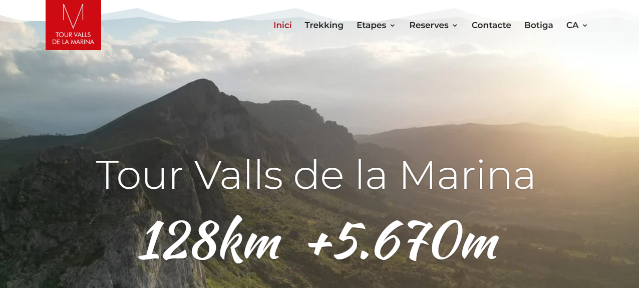
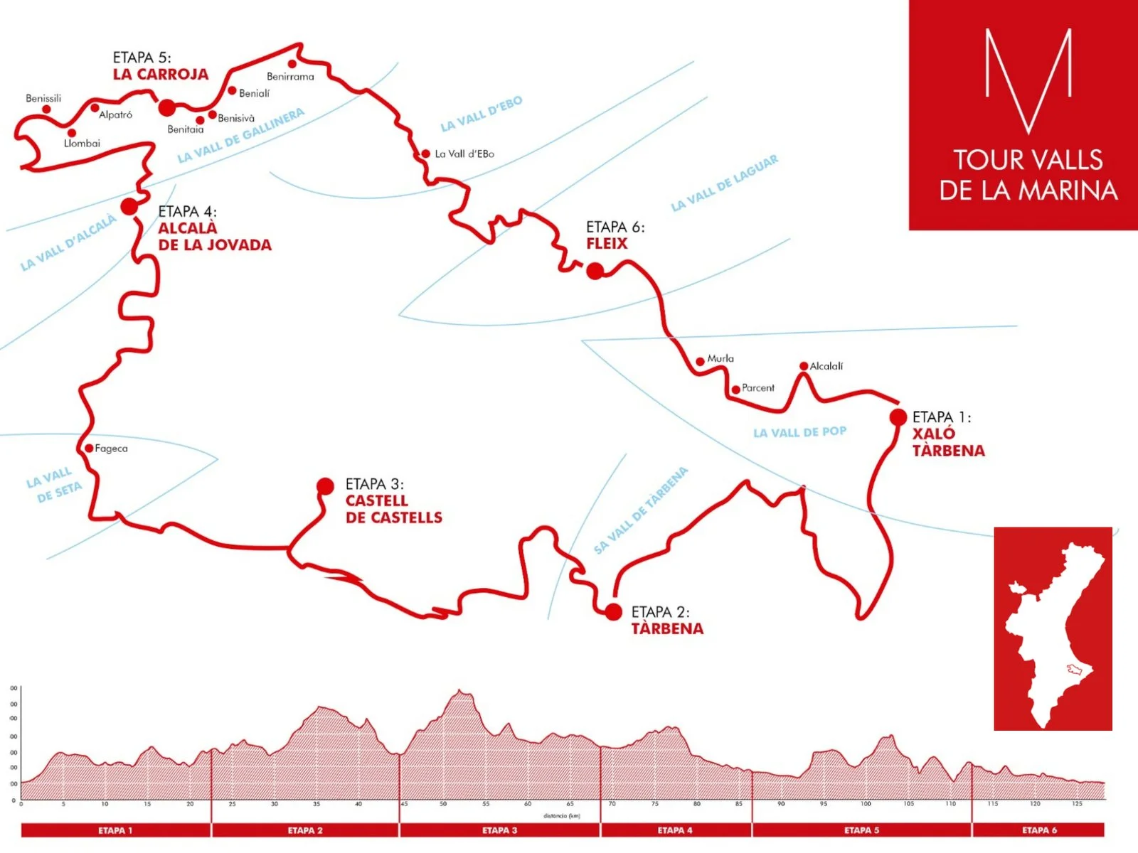
The TOUR VALLS DE LA MARINA is a circular mountain trek of 128 km and 5,670 m of positive difference in altitude that links the valleys of Xaló and Pop, Tàrbena, Castells, Seta, Alcalà, Gallinera, Ebo and Laguar, crossing mountain ranges such as Bèrnia, la Xortà, la Serrella, la Foradada or la Carrasca among others.
The Valls de la Marina Tour is a complete experience. A self-guided tour with accommodation at the end of each stage and with the support and advice of a team that knows and loves our villages and mountains.
The complete route consists of 6 stages, but you can do it in 7 or 8 days. Or you can do only the southern half (TVM South) in 3 stages or the northern half (TVM North) in 3 stages. From the website www.tourvallsdelamarina.com, they provide you with the booking of accommodation and all the information and services necessary to walk safely and comfortably.
And if you don't have mountain experience or want to be accompanied by a qualified local mountain guide, the guided trekking is your option, which you will soon be able to book through the website.
The proposed dates are from the 15th of September to the 15th of July to avoid extreme temperatures and fire hazards. The organisation also gives you a series of recommendations to take into account:
***
1) The TVM route, with its own signposting, runs along trails with a long hiking tradition, coinciding in large part with sections of GR, PR and local and traditional trails. We can also follow the path thanks to the milestones (piles of stones) that other mountaineers built before us. Even so, it is essential to use a GPS and prepare the itinerary with the guidebook and official tracks.
2) Be aware of the weather conditions. Avoid strong storms, cold drops or very hot days.
3) Bear in mind that during a large part of the route there may not be mobile phone coverage, neither to call nor to download online maps. It should be downloaded before the start of the stage.
4) Be aware of your physical condition and act accordingly. The stages are long and the slopes are steep. You need to be fit and used to walking in the mountains.
5) Equip yourself with technical clothing and footwear. Carry only the essential weight in your backpack. Protect yourself from solar radiation, don't forget a hat, sun cream and sunglasses.
6) Plan for the water and food you will need. Bring enough water supplies for the route and drink regularly. Remember that the springs you may find may be dry.
7) The mountain is for sharing. Always try to go with companions.
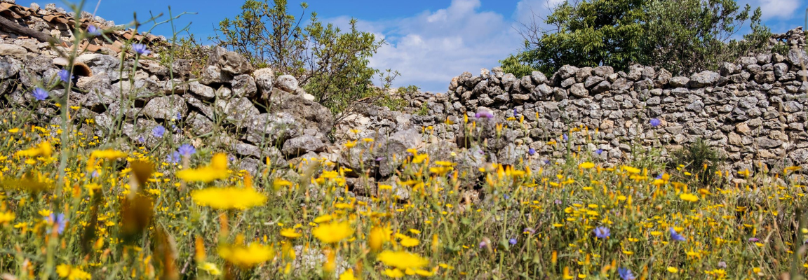
8) The Valls de la Marina Tour passes through ecologically fragile natural areas with a great diversity that must be cared for and protected. Respect for the environment is extremely important. Do not make any noise or leave any traces in your wake.
9) Plan time to stay, rest and enjoy our villages. Eat local products.
PROPOSED DAYS. Step by step we make the way.
STAGE 1. From Xaló to Tàrbena.
Distance: 22,53 km
Positive difference in altitude: +1.025 m
Negative difference in altitude: -671 m
Estimated duration: 6 hours
 Panoramic view of the Coll de Rates. Tàrbena path.
Xaló and Tàrbena are two towns historically linked by a common link: the Mallorcan town of Santa Margalida, from where a very significant part of the new settlers of both towns came after the expulsion of the Moors in 1609. The natural passage between these two valleys crosses the Coll de Rates along the azagador path. In this itinerary we have chosen to first make an approach to the essential mountain range of Bèrnia to end up linking through Masserof to the legendary Coll de Rates (or Raptes, abductions). This place frequented by bandits and highwaymen throughout history is almost the only natural pass that offers the succession of the mountain ranges of Bèrnia, Ferrer and Carrascar de Parcent, as well as the steep and very hidden pass of the Bandoleros.
The stage links the valley of Xaló with the valley of Tàrbena, and has three well-defined sections. The first part will take you from the village of Xaló to the phenomenal mountain range of Bèrnia, which you will see in the distance, through the classic ascent to les Planisses; the second part goes through the Marnes district, breaks to descend towards the Baró ravine, with exceptional dry stone margins, and crosses the village of Masserof, from where you will access the mythical Coll de Rates through the Negre ravine. The third part of the stage will take you along the old path of Tàrbena, which crosses the hamlet of Cassivanyes and goes up the path of Sa font de Benissalim to the charming village of Tàrbena.
STAGE 2. Form Tàrbena to Castell de Castells.
Distance: 22,44 km
Elevation gain: +892 m
Negative difference in altitude: -904 m
Estimated duration: 6 hours 30 minutes
 Going down to Castell de Castells.
This stage covers very little travelled terrain with a great variety of landscapes. The first part runs along an almost circular route through the area of Sa Muntanya and the surprising cliffs of the Tancat pass, an absolutely captivating place.
We could have saved a couple of kilometres at the start by leaving Tàrbena by the Calvary, just behind the cultural centre, but the attraction of this first section justifies the initial return that marks the route.
After a stretch that runs mainly along a track, you will reach the foot of the Garx castle. The spectacular views of the coast are another of the highlights of this day. The second part of the stage accumulates almost all of the difference in altitude. It climbs through the mountain range of Rincón Roig and goes in search of the mountain range of Xortà (or Aixortà, as they say in Callosa d'en Sarrià).
The word ‘Xortà’, according to Coromines, derives from lucertu, which means ‘lizard’. At the Els Teixos spring, botany lovers can enjoy a very interesting micro-reserve of flora. The Peña Alta de la Xortà and the Foia Plana, together with the route that goes to the hut of the tio Alcoià are also very interesting stretches. The last part of the stage is mainly on a track, although it has an apotheosis ending with the ascent to the ruins of the Castellet, which must be explored before descending along a path to the village of Castell de Castells.
STAGE 3. From Castell de Castells to La Vall d’Alcalà.
Distance: 27,12 km
Positive difference in altitude: +1.385 m
Negative difference in altitude: -1,280 m
Estimated duration: 7 hours
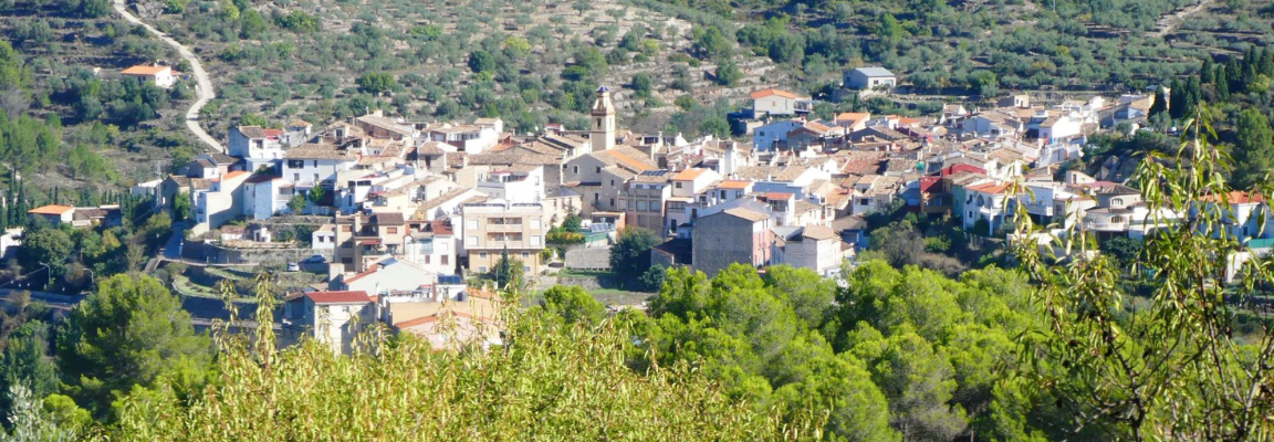
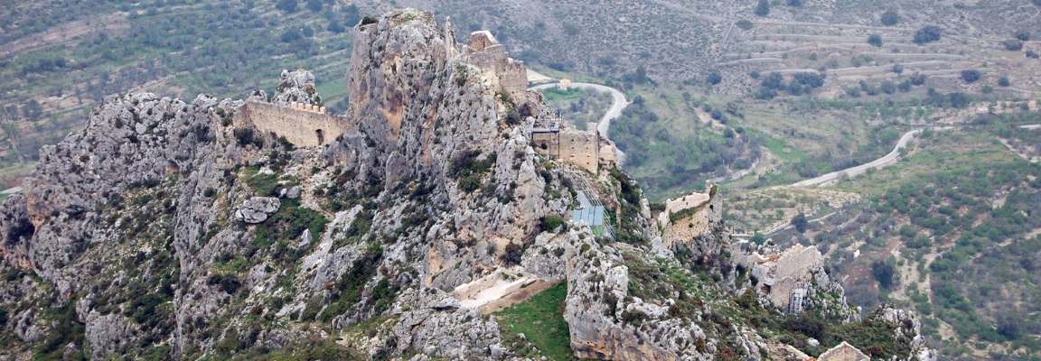
 Remains of Moorish settlements in La Vall d'Alcalà.
This stage straddles the Marina Alta and Comtat regions, and consists of two very different parts.
The first part is much wilder, and begins with a good ascent from Castell de Castells to the Bancal del Aire, and from here through the magnificent ravine of La Canal where we will find the Pouet de la font del Cantal, the pouet de la Noguera and a snowdrift, the three vestiges of the production and trade of snow. This ravine and the last stretch to reach the summit of Malalda del LLop (1,360 m) is quite spectacular. Afterwards, you will climb up the mountain range to end up descending towards the village of Fageca, an excellent place to spend the night if you decide to do this stage in two days.
The second part of the stage starts in Fageca and follows the PR-CV 168 until you reach the Malafí ravine in the municipality of Tollos, a natural access route to the coast. We leave the Malafí ravine immediately to walk the rest of the stage along a forest track. In this last stretch we must highlight the very interesting farmhouses of Capaimona, the uninhabited Moorish village of Saltes, with cave wine presses dug into the rock, and finally, the delightful village of Alcalà de la Jovada.
STAGE 4. Form La Vall d’Alcalà to La Vall de Gallinera.
Distance: 17,84 km
Elevation gain: +490 m
Negative difference in altitude: -777 m
Estimated duration: 5 hours
 Castle of Alcalà or Benissili.
The route of this stage links two authentic natural paradises, the Vall d'Alcalà and the Vall de Gallinera, passing through a large number of places of immense heritage and natural value.
The first part of the itinerary leaves the village of Alcalà de la Jovada through the excellently preserved nevera de Baix and the obligatory visit to the Moorish settlement of l'Atzuvieta, and takes us to the rocky arch of La Foradada, From there, we will take a beautiful walk along the ridge that will lead us to the Panyal Gros, the Tossal de la Creu and the Lloma del Xarpolar, already at the western end of the mountain range, where there are the remains of an important Iberian settlement. Then you will go down a terraced hollow on the northern slope of the mountain range to look for the imposing remains of the castle of Alcalà, which you should also explore.
The second part of the stage begins with a steep descent from the castle of Alcalà to the bottom of the Vall de Gallinera. Afterwards, you will walk by the Mata spring, the Moorish settlement of Solaneta and the threshing floors that will welcome you at the entrance to Benissili.
To conclude the stage we still have the interesting and almost uninhabited village of Llombai and the pretty villages of Alpatró and La Carroja.
Although the itinerary described ends in La Carroja, this stage allows you to spend the night in any of the villages of the Vall de Gallinera, shortening or lengthening the route by a few kilometres.
STAGE 5. From La Vall de Gallinera to La Vall de Laguar.
Distance: 26,84 km
Positive difference in altitude: +1.482 m
Negative difference in altitude: -1.393 m
Estimated duration: 8 hours
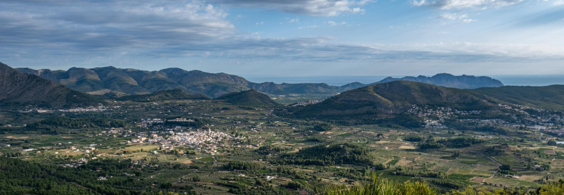
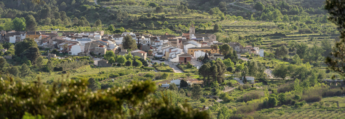 Panoramic view of La Vall d'Ebo and its crops.
This demanding stage starts in Carroja (Vall de Gallinera), crosses Vall d'Ebo, and ends in Fleix (Vall de Laguar).
Leaving Carroja, we head towards Benitaia, Benissivà and Benialí, from where, along a path that runs through the Solana del Valle, we reach the village of Benirrama.
The climb to the Passet de Benirrama is one of the main attractions of the day.
After this intense climb that will take us out of Vall de Gallinera, we will descend along the old path that connects the Passet with the Moorish village of La Solana, from where we will access the town centre of Vall d'Ebo, an excellent place to spend the night if we decide to do this long and very hard stage in two days.
From Vall d'Ebo there is a steep ascent to El Morral, to the beautiful Carrasca mountain range. When we reach the highest point, we will walk along the mountain range in the direction of Vall de Laguar. The views along this stretch are truly breathtaking, with the narrow gorge of the Barranco del Infierno at our feet, and 360° views of all the most important mountain ranges of the central Valencian regions.
From the carena de la Carrasca we will begin a somewhat difficult descent to the Juvees de Dalt, an interesting group of old farmhouses, from where we will follow a good stretch of the popular PR-CV 147, an unrepeatable walk that runs along the Infern ravine and its nearly 7,000 steps carved into the mountain itself, passing by the Reinós spring, the Juvees d'Enmig, the Forat and the Font Grossa until we reach the village of Fleix.
STAGE 6. From La Vall de Laguar to Xaló.
Distance: 15,84 km
Elevation gain: +303 m
Negative difference in altitude: -548 m
Estimated duration: 3 hours 30 minutes
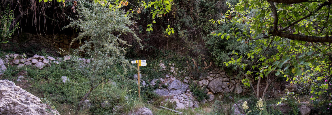 Path to the shady area of La Vall de Laguar.
This stage is a pleasant walk between Vall de Laguar and the Pop/Xaló valleys. Despite the shorter distance, the negative slope of the route, and the characteristics of a less rugged route than the rest of the days, there are a good number of points of interest, and both the cultivated areas and the villages through which it passes are very attractive.
Along the route of the stage, you can enjoy the cherry trees of the Vall de Laguar, which are in bloom in March, and in May you can taste cherries of extraordinary quality; taste the fresh water that trickles through the bowels of the mythical Cavall Verd mountain range until it springs in the Font del Gel, and take a leisurely stroll along the emblematic wall of the Fontilles sanatorium; go up to the hermitage of San Sebastián before crossing the village of Murla through the fortress church of Sant Miquel and perhaps stumble upon a game of pelota; cross the river to look for the delicious Durmais pond with its tiny orchards and access Parcent through the phenomenal Lavadero; admire the strength of the medieval tower of Alcalalí and close the walk along the path of the Tarafes to Xaló, with the satisfaction of having completed all the stages of this demanding challenge.
You can also purchase the Valls de la Marina Tour Guide in the shop on the official website www.tourvallsdelamarina.com/tenda/:
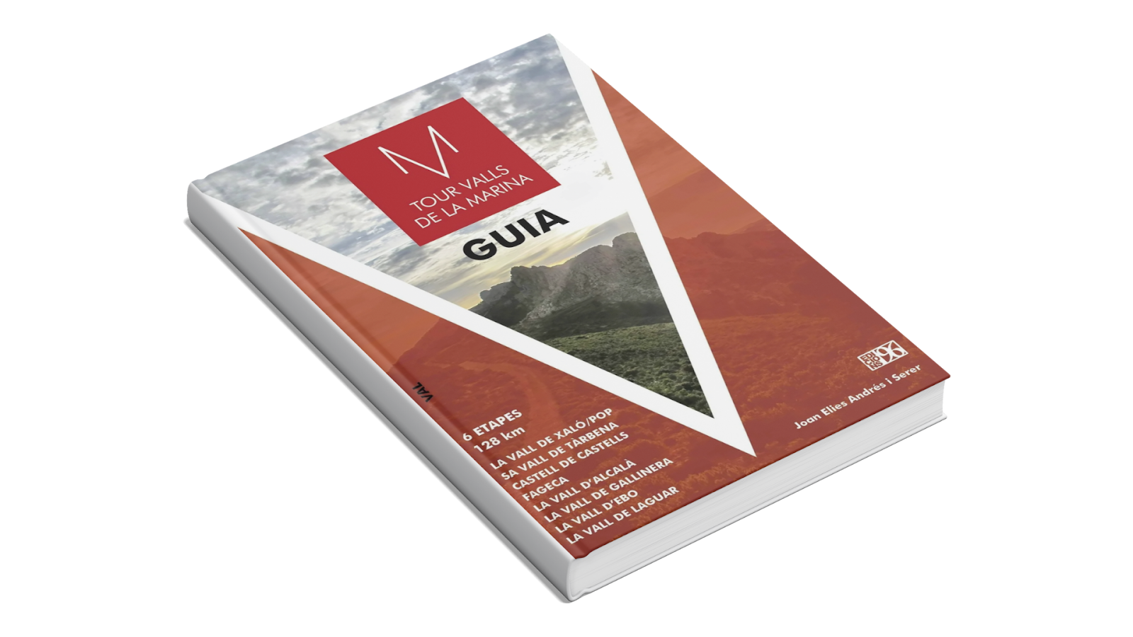
This guide is the paper version of the Tour Valls de la Marina, a journey of 128 kilometres and 5670 m of positive height gain, which invites you to connect with the territory. More than a simple description of the stages, this work is an essential tool for reading and understanding the rich historical and cultural heritage of our mountains with articles on local fables, traditions, characters and charming villages of this incomparable natural and cultural mosaic that make up the valleys of the Marina.
UPCOMING PRESENTATIONS OF THE BOOK TO GET TO KNOW THE PROJECT BY THEIR AUTHORS:
[ Dates available soon ]
*This experience is designed to be done in 6 stages, although there is the possibility, according to the organisation, of doing it in 8 stages or dividing it into two sections to be done on two separate occasions. Each person can adapt the experience to their abilities, physical endurance and interests. If you want more information about the tour, don't hesitate to visit the website www.tourvallsdelamarina.com and follow them on their instagram account @tourvallsdelamarina.
Or if you want more information about the elements to visit in each village, you can enter the website of Descobrim la Marina Alta and search for it.

AND MORE...
 Where to buy |  Where to eat |
 Where to sleep |  Other activities |